You're missing hotspots.
You just can't see which ones…
Stop mopping-up blindly — stop kicking rocks — stop aimlessly squirting water. Go directly to the heat, verify it, and put it out.
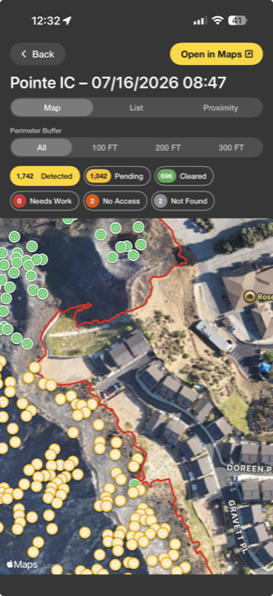
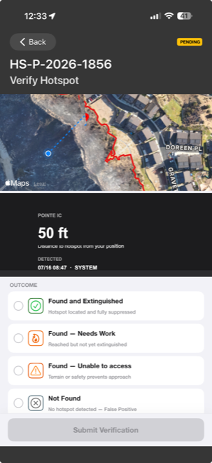
The FireSync OPS App — HotSpot Finder, paired with your agency's UAS platform, puts every detected hotspot directly in front of your crew as a specific, trackable location — no more guessing.
This pushes live to every crew member's own phone, letting each firefighter work independently.
Missed heat can become a rekindle. A rekindle can mean lost homes — or lost lives.
A holdover from the incompletely mopped-up Lachman Fire — it smoldered underground in the roots for six days before flaring back to life.
The 1.8-acre Balcom Fire was declared out. A week later, Santa Ana winds carried hot debris off the same scorched tractor tire into dry brush — 20,000 acres burned.
Fewer person-hours on mop-up. Lower cost per incident. Reduce unnecessary staffing — staff more appropriately.
Finds heat buried under ash, soil, and debris — heat your crew would never otherwise see. No guessing if an area has been worked already.
Walk straight to the coordinate. Less time on scene. Less water used. Less crew exposure to smoke and heat.
"Work everything within 100 feet of the perimeter." — IC
A digital PDF map — or a paper map and a pen. Check off each spot by hand. Nothing updates in real time. You can't see live progress, and you don't know if an area has already been worked.
One tap. The map now shows exactly the heat threatening the line.
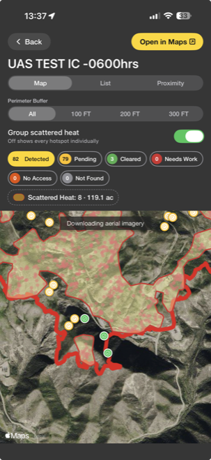
Scattered heat, grouped — not 82 pins to chase one by one.
Dense, scattered detections roll up into a single acreage — "Scattered Heat: 8 · 119.1 ac" — so your crew reads a burn area, not a wall of icons. Toggle off to see every point individually when you need to.
"It's not just efficiency — it's accountability, confidence, prevention."
Get FireSync OPS